Welcome
The purpose of the Solid Earth Centre is to facilitate access to data and contribute to the creation of new products and services by adding value to the available spatial and in-situ data. It is part of the national and European landscapes in close coordination with the infrastructure in place and under construction.
For this, the Solid Earth Center, has the task to federate the existing centres in the service of the Solid Earth community.
It relies on a portal giving access to spatial data, in-situ and experimentation of the domain. It aims to provide added value, especially for data and services in fields where data centres do not exist or need to be developed and in the articulation with European and international systems. The Center, in collaboration with other structures in the field and within the research infrastructure Data Terra, will strengthen the Solid Earth community by giving it access to the data and products it needs to his research.
ForM@Ter OIC2024: Optical Image Correlation Challenge
The ForM@Ter OIC2024 Challenge aims to promote research in the use of satellite offset tracking techniques applied to optical imagery for the detection and quantification of displacement and velocity of various geological objects.
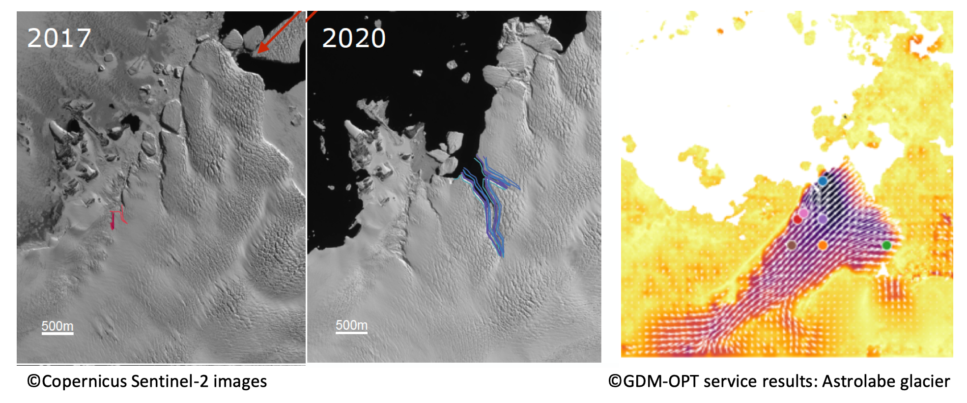
ForM@Ter and THEIA release a serie of very high resolution topographic models of 140 glaciers worldwide through the PGO FAIR collection
The Pléiades Glacier Observatory (PGO) was initiated in 2016 by French Space Agency (CNES), by the Laboratoire d’Etudes Géophysiques et Océanographiques Spatiales (LEGOS) and by the Institut National des Sciences […]
The Solid Earth community and applications for developing countries
In a digital environment that is very rich in terms of supply and content, and evolving very quickly, not all players are equal when faced with the growing need and […]
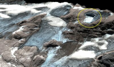
Estimation of Marmolada glacier collapse volume using Pléiades imagery
The deadly Marmolada glacier collapse happened on 3 July 2022. On 6 July 2022, Pléiades 1B (CNES, Airbus DS) acquired a clear-sky stereo pair of the area. From these images we could estimate a […]
PHYSICIST POSITION FOR ISDEFORM
The National Observation Service (SNO) ISDeform, in connection with the « pôle de données et de services » ForM@Ter, is looking to hire a physicist in one of the Observatory of the Sciences of the Universe (OSU) partners of the SNO
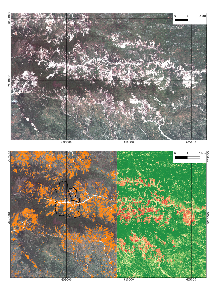
Analysis performed with the ALADIM GEP service to construct automated landslide inventories using Pléiades very-high resolution images
On 14-08-2021, a Mw 7.2 earthquake hit Haïti. This event was followed by a few days of heavy rains triggered by tropical depression Grace. The combination of these extreme phenomena triggered a large number of landslides in the hilly region of Haïti, especially in the region of the Pic Macaya National Park.
April 2021 eruption at Piton de la Fournaise imaged by Sentinel-1
On April 9th 2021 at 15:00 UTC, a new eruption started at Piton de La Fournaise volcano. Using C-band Sentinel-1 data provided by European Space Agency (ESA), the OI2/ISDeform/INSU Observation Service has imaged the ground surface displacements induced by the eruption.
Copernicus DEM 30 m available online with a free and open licence
The access rights for the Copernicus DEM with globalcoverage at 30 meter resolution (GLO-30) have now been extended and the dataset is openlyavailable to any registered user. More information: https://spacedata.copernicus.eu/fr/web/cscda/explore-more/news-archive
Follow ForM@Ter
Data Terra poles
RESIF news
EPOS news