SRTM data
The National Geospatial Intelligence Agency (NGA), announced that the highest-resolution (30 m) topographic data over Africa generated from NASA’s Shuttle Radar Topography Mission (SRTM) will be released globally. For more […]

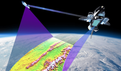
The National Geospatial Intelligence Agency (NGA), announced that the highest-resolution (30 m) topographic data over Africa generated from NASA’s Shuttle Radar Topography Mission (SRTM) will be released globally. For more […]
L’information concernant les thèmes qui étaient retenus pour le futur ITT de l’ESA a été publiée mi-février: * Coastal Environment TEP * Forestry TEP * Hydrology TEP * Polar TEP […]
SPOT (Satellite Pour l’Observation de la Terre) is an high-resolution satellite system. It was initiated by CNES in the 1980s for its Earth observation programme. With over 30 million images […]