News

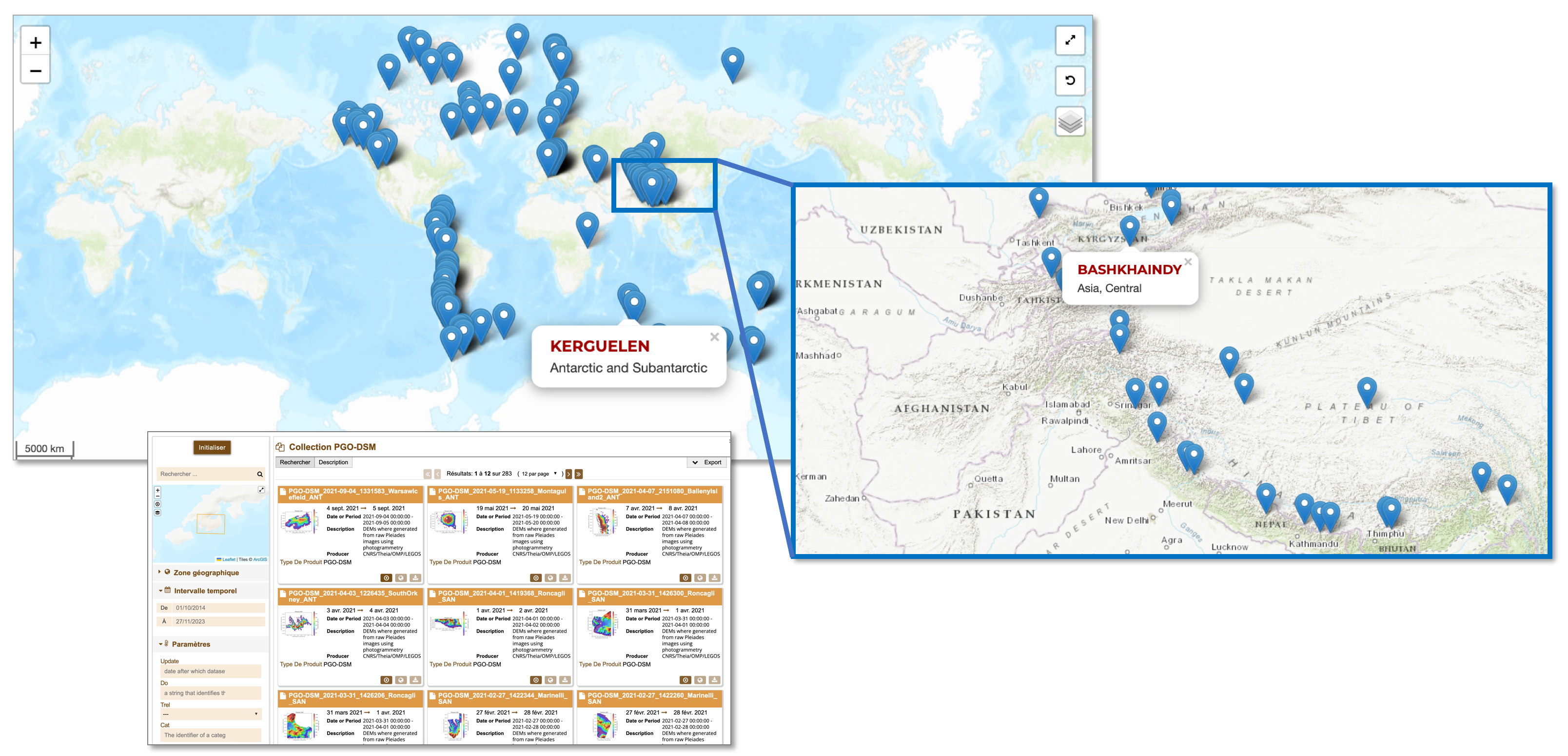
ForM@Ter OIC2024: Optical Image Correlation Challenge

The ForM@Ter OIC2024 Challenge aims to promote research in the use of satellite offset tracking techniques applied to optical imagery for the detection and quantification of displacement and velocity of various geological objects.

Catalog

ForM@Ter and THEIA release a serie of very high resolution topographic models of 140 glaciers worldwide through the PGO FAIR collection

The Pléiades Glacier Observatory (PGO) was initiated in 2016 by French Space Agency (CNES), by the Laboratoire d’Etudes Géophysiques et Océanographiques Spatiales (LEGOS) and by the Institut National des Sciences […]

ISDeform

The Solid Earth community and applications for developing countries

In a digital environment that is very rich in terms of supply and content, and evolving very quickly, not all players are equal when faced with the growing need and […]

CIEST 2

Estimation of Marmolada glacier collapse volume using Pléiades imagery

The deadly Marmolada glacier collapse happened on 3 July 2022. On 6 July 2022, Pléiades 1B (CNES, Airbus DS)  acquired a clear-sky stereo pair of the area. From these images we could estimate a […]

Job offer

PHYSICIST POSITION FOR ISDEFORM

The National Observation Service (SNO) ISDeform, in connection with the « pôle de données et de services » ForM@Ter, is looking to hire a physicist in one of the Observatory of the Sciences of the Universe (OSU) partners of the SNO

CIEST 2

Analysis performed with the ALADIM GEP service to construct automated landslide inventories using Pléiades very-high resolution images

On 14-08-2021, a Mw 7.2 earthquake hit Haïti. This event was followed by a few days of heavy rains triggered by tropical depression Grace. The combination of these extreme phenomena triggered a large number of landslides in the hilly region of Haïti, especially in the region of the Pic Macaya National Park.

ISDeform

April 2021 eruption at Piton de la Fournaise imaged by Sentinel-1

On April 9th 2021 at 15:00 UTC, a new eruption started at Piton de La Fournaise volcano. Using C-band Sentinel-1 data provided by European Space Agency (ESA), the OI2/ISDeform/INSU Observation Service has imaged the ground surface displacements induced by the eruption.

News

Copernicus DEM 30 m available online with a free and open licence

The access rights for the Copernicus DEM with globalcoverage at 30 meter resolution (GLO-30) have now been extended and the dataset is openlyavailable to any registered user. More information: https://spacedata.copernicus.eu/fr/web/cscda/explore-more/news-archive

Presentation

Back on the MDIS workshop 2019

From 14th to 18th October 2019, EOST and IPGS hosted the MDIS-2019 training course and conference.
The webpage hosting most of the MDIS material (training classes, oral and poster presentations) is available.