Welcome
The purpose of the Solid Earth Centre is to facilitate access to data and contribute to the creation of new products and services by adding value to the available spatial and in-situ data. It is part of the national and European landscapes in close coordination with the infrastructure in place and under construction.
For this, the Solid Earth Center, has the task to federate the existing centres in the service of the Solid Earth community.
It relies on a portal giving access to spatial data, in-situ and experimentation of the domain. It aims to provide added value, especially for data and services in fields where data centres do not exist or need to be developed and in the articulation with European and international systems. The Center, in collaboration with other structures in the field and within the research infrastructure Data Terra, will strengthen the Solid Earth community by giving it access to the data and products it needs to his research.
ForM@Ter OIC2024: Optical Image Correlation Challenge
The ForM@Ter OIC2024 Challenge aims to promote research in the use of satellite offset tracking techniques applied to optical imagery for the detection and quantification of displacement and velocity of various geological objects.
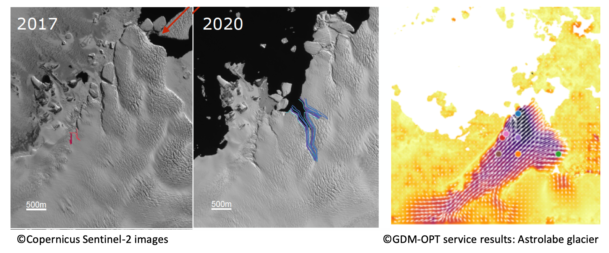
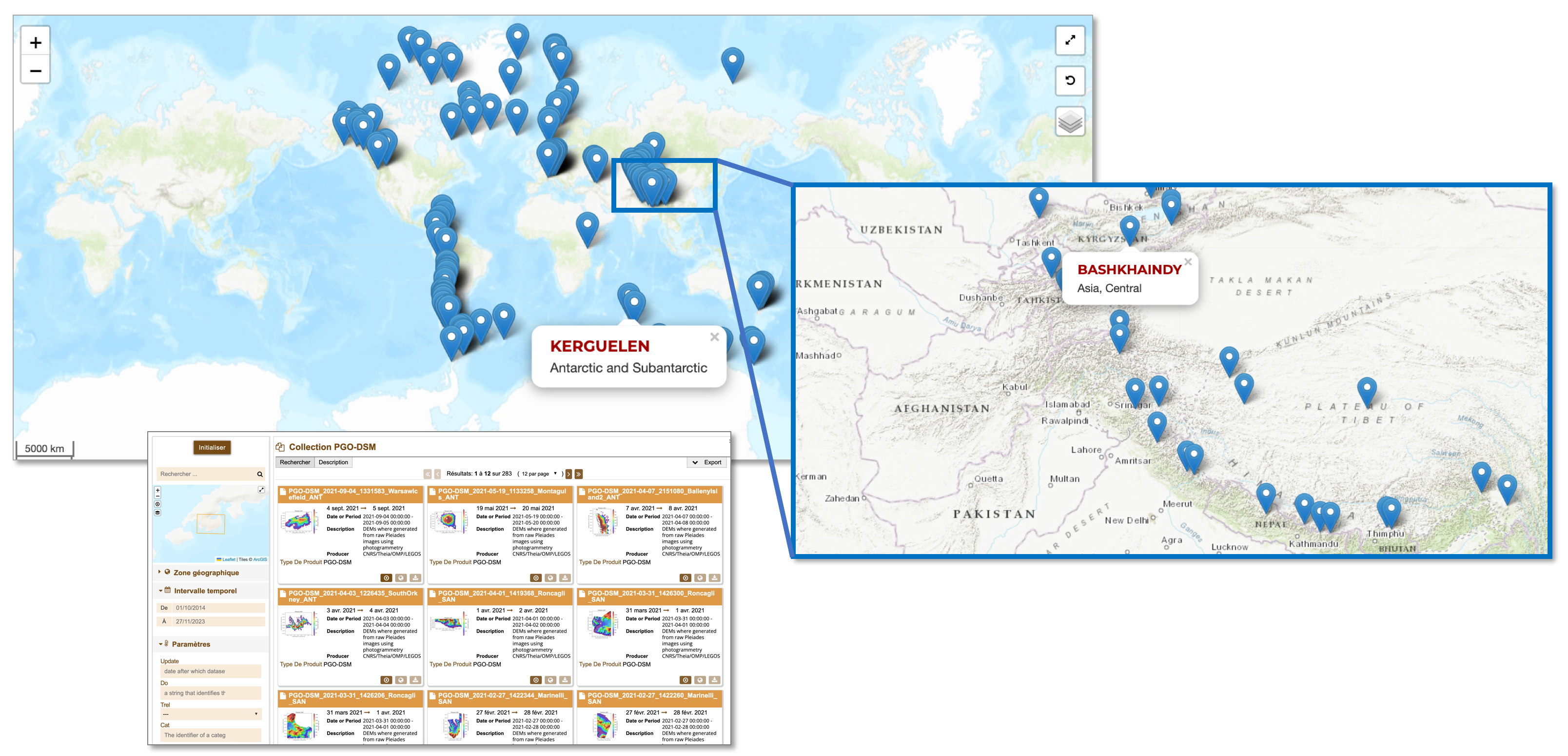
ForM@Ter and THEIA release a serie of very high resolution topographic models of 140 glaciers worldwide through the PGO FAIR collection
The Pléiades Glacier Observatory (PGO) was initiated in 2016 by French Space Agency (CNES), by the Laboratoire d’Etudes Géophysiques et Océanographiques Spatiales (LEGOS) and by the Institut National des Sciences […]
The Solid Earth community and applications for developing countries
In a digital environment that is very rich in terms of supply and content, and evolving very quickly, not all players are equal when faced with the growing need and […]
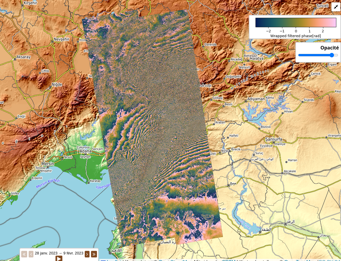
Co-sismique – Turquie/Syrie – 2023
Interferogrammes cosismiques sur la séquence sismique du 6 Février 2023 en Turquie, Mw 7.8 et 7.5. Interférogrammes couvrant les deux séismes décrochants de forte magnitude du 6 Février 2023. Le […]
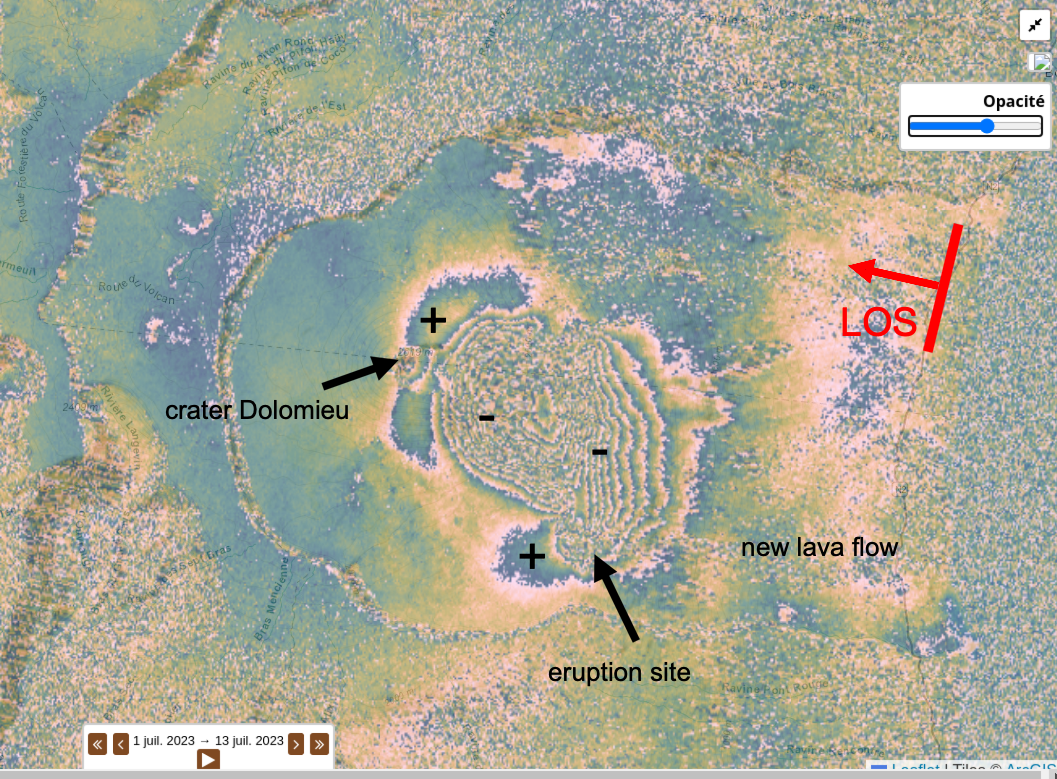
Déformation volcanique – La Réunion – 2023
Produits interférométriques couvrant l’éruption de Juillet 2023 du volcan Piton de la Fournaise [orbite descendante, résolution enroulée : 2 looks, résolution déroulée : 2 looks, sans correction atmosphérique, 4 bursts […]
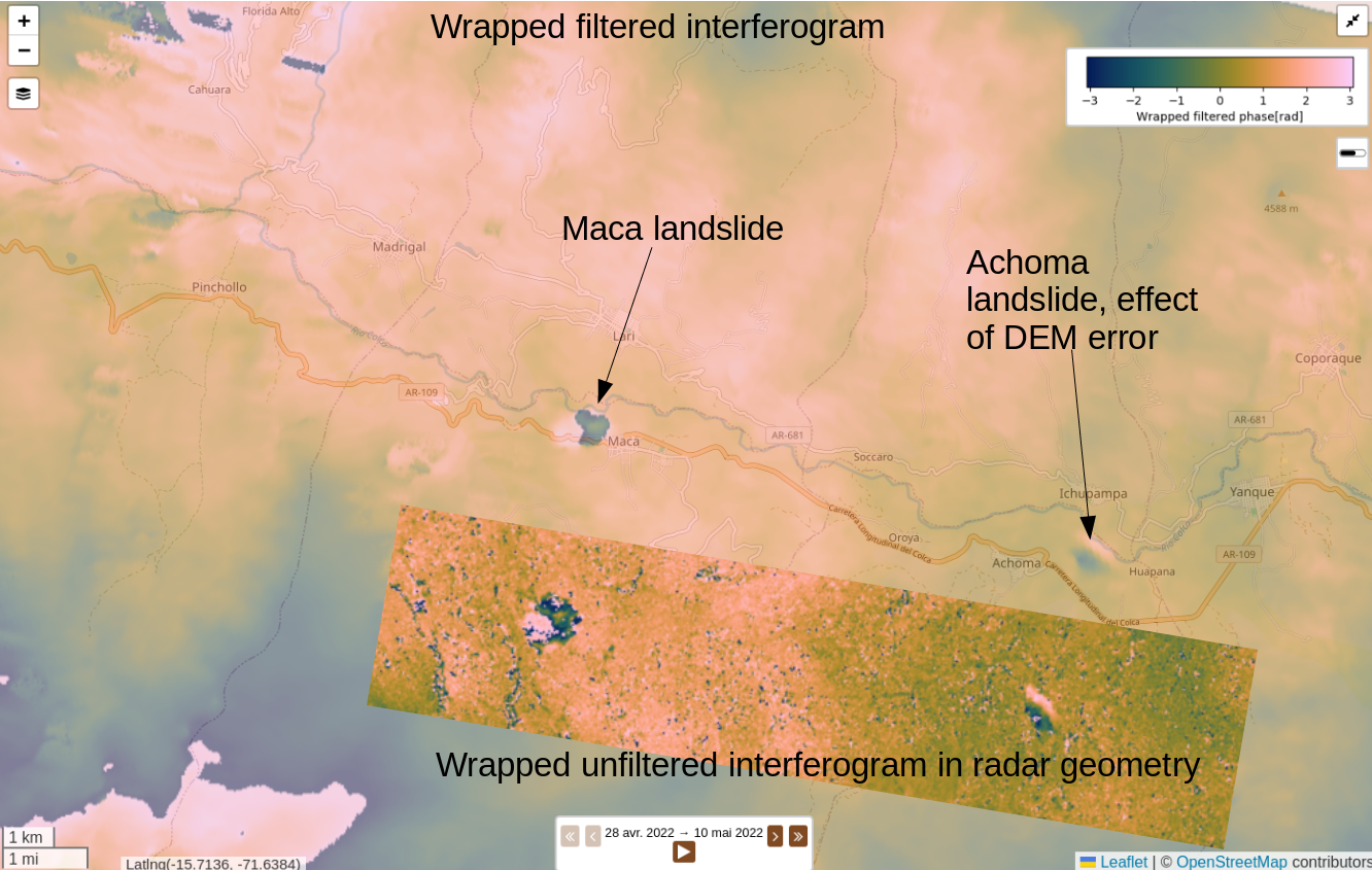
Glissement de terrain – Pérou – 2022
Série sur les glissements de terrain de la vallée de Colca au Pérou entre Avril et Août 2022. Interférogrammes couvrant les glissements de terrain de la vallée de la Colca. […]
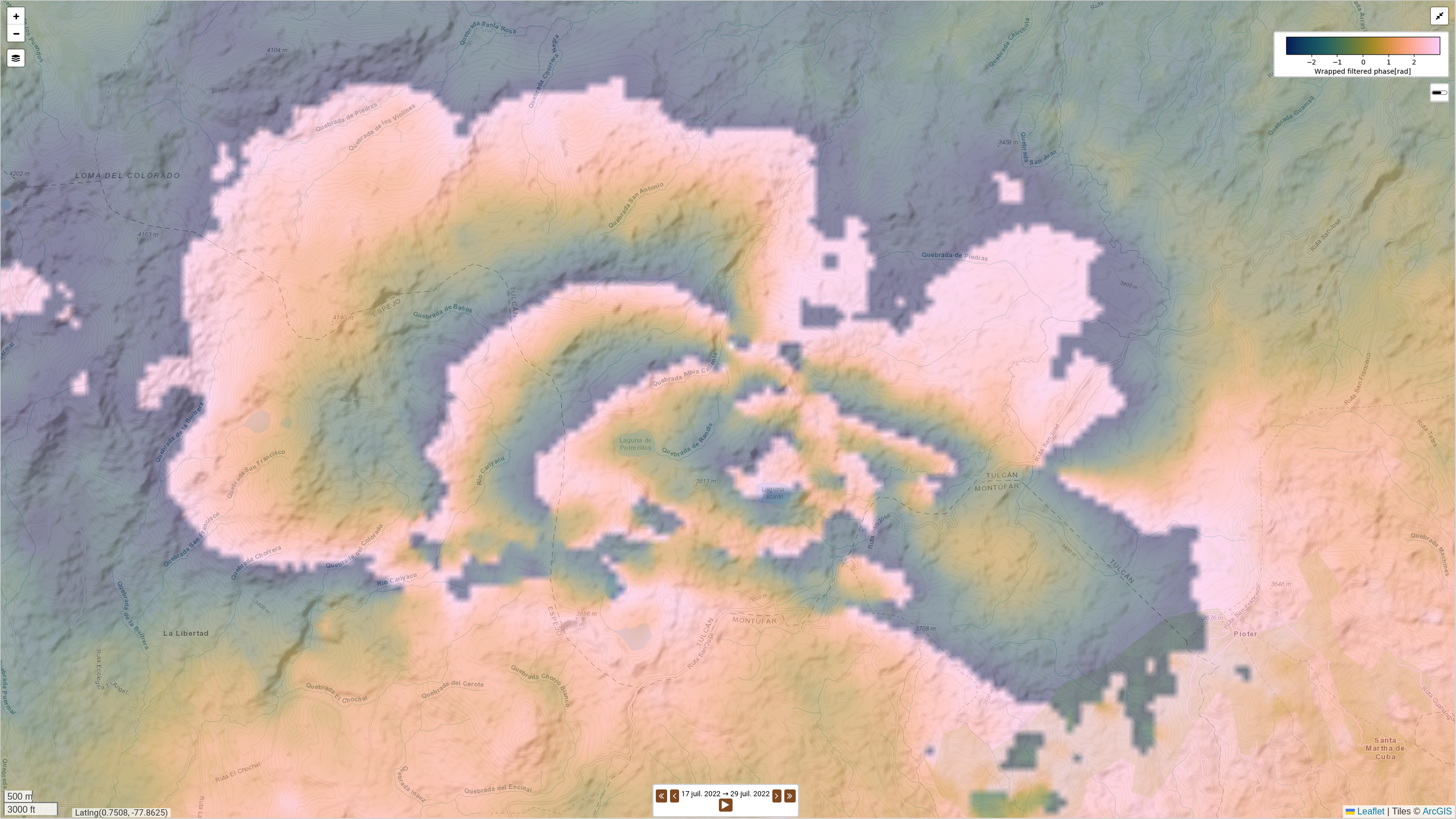
Co-sismique – Equateur – 2022
Série co-sismique et post-sismique courte sur le séisme Mw 5.7 de San Gabriel – Ibarra du 25/07/2022. Série d’interférogrammes couvrant un séisme de magnitude modérée avec une légère déformation post-sismique. […]
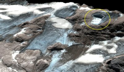
Estimation of Marmolada glacier collapse volume using Pléiades imagery
The deadly Marmolada glacier collapse happened on 3 July 2022. On 6 July 2022, Pléiades 1B (CNES, Airbus DS) acquired a clear-sky stereo pair of the area. From these images we could estimate a […]
Follow ForM@Ter
Data Terra poles
EPOS news