The GDM-SAR-In (Ground Deformation Monitoring using SAR Interferometry) on-demand processing service is a Data Terra service developed and operated by its solid Earth hub, FormaTerre, in collaboration with ISTerre (OSUG), IPGP, CNES and the ISDeform NOS. The service is deployed on the CNES computing center. It was set up with the support of CNES and CNRS/INSU.
It is linked to the Thematic Core Service « Satellite Data » of the European research infrastructure EPOS, as GDM-SAR-In provides products that can be exposed on the EPOS data portal.
GDM-SAR-In uses the NSBAS processing chain (Doin et al., 2011, Grandin, 2015) to process radar images acquired by the Sentinel-1 satellites (in IW mode) of the Copernicus program. It enables the user to calculate interferograms or InSAR time series, as well as other associated products (see examples of applications and products). Detailed product descriptions are available in a dedicated document. This service is complementary to FormaTerre’s FLATSIM service, providing an easy-to-use InSAR data exploration tool and delivers results quickly, but on limited data volumes. Quantitative exploitation of the results requires a degree of expertise and potentially re-analysis by the user.
In its initial phase, GDM-SAR-In is accessible to national users, in particular within the RI Data Terra framework, via the FormaTerre portal. The service is accessible to anyone with a FormaTerre account, subject to acceptance of their profile: to access the service, you need to authenticate yourself by following the instructions.
Conditions of use are detailed in the service charter available on the service access page.
Qualified and validated products from the GDM-SAR-In service are made available in the FormaTerre’s metacatalog under a CC-BY-NC license, excluding any commercial use.
This service has been developed to make it easier for users to launch InSAR processing with simple option choices, without having to worry about setting up and maintaining a complex processing chain (including downloading Sentinel-1 images, precise orbit data, digital terrain model and atmospheric model data, and the demanding TOPSAR mode processing of Sentinel-1 acquisitions) on a computing cluster.
GDM-SAR-In also provides to more expert users, a quick and easy way to explore a new area or a specific process such as a volcanic or seismic crisis, while keeping a certain flexibility in the choice of process parameters and the possibility to repeat parts of the process if necessary, thanks to the availability of intermediate products and process information.
PLEASE NOTE: Measuring ground deformation using radar interferometry is a complex process, with the choice of parameters depending on the nature of the ground in the studied area, variations in atmospheric conditions and the process studied. This makes it difficult to implement fully automatic processing. For the GDM-SAR-In service, choices had to be made. These choices are the result of compromises between ease of use, robustness, allocated computing time and resources, and the diversity of the products provided, which implies limitations that are discussed in a dedicated document.
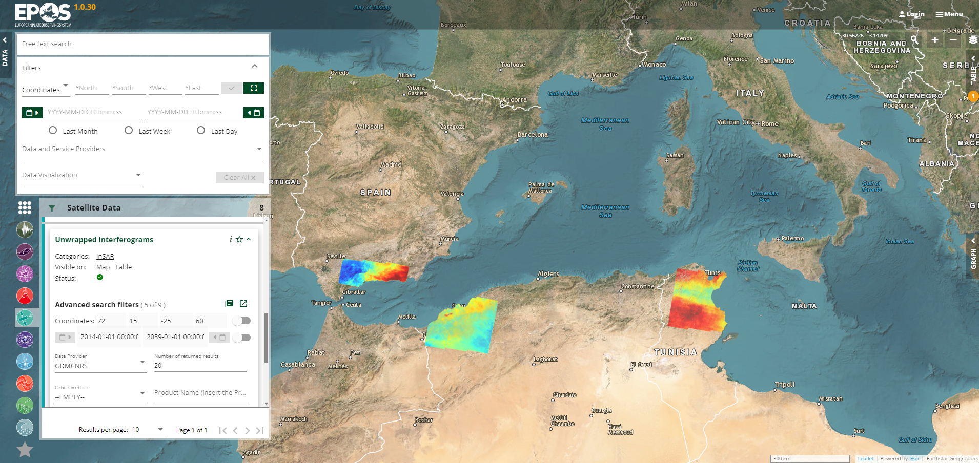
The GDM-SAR-In service uses OGC standards and follows the recommendations made in the RI Data Terra framework, whether in terms of webservice development (WPS standard), the format of output products (GeoTIFF), the standard used for metadata (GeoJSON) or the type of metadata entered. This is compatible with RI EPOS: the format of the products and metadata enables the results to be ported to the EPOS platform so that they can be displayed on the European RI data portal (example below of unwrapped interferograms from the GDM-SAR-In service displayed on the EPOS data portal).
Applications are multidisciplinary: monitoring of telluric hazards (volcanic eruptions, earthquakes, landslides, etc.), hydrology, etc.
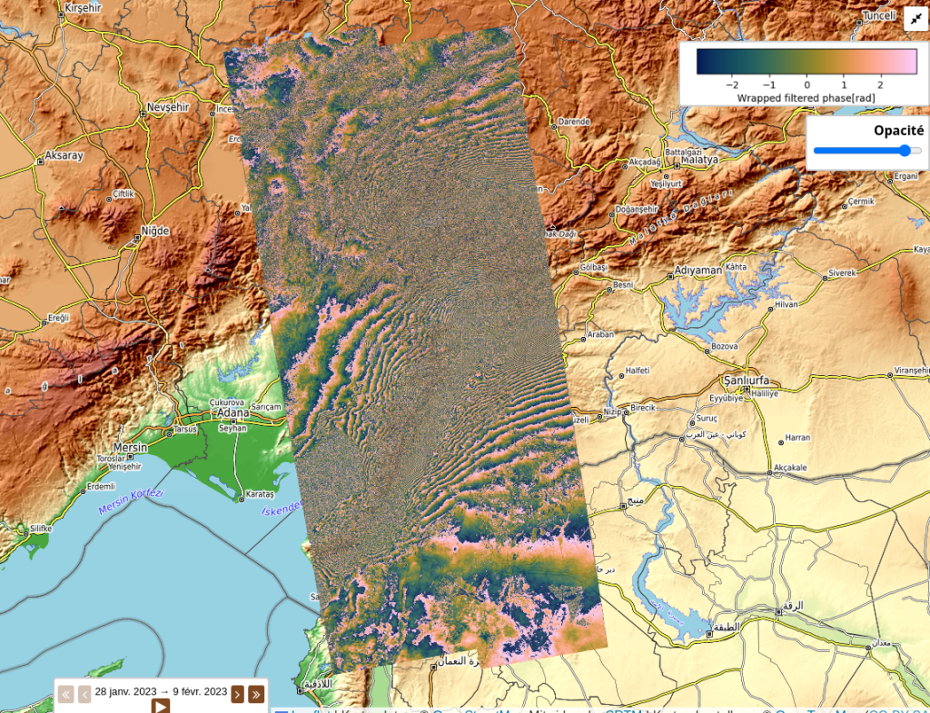
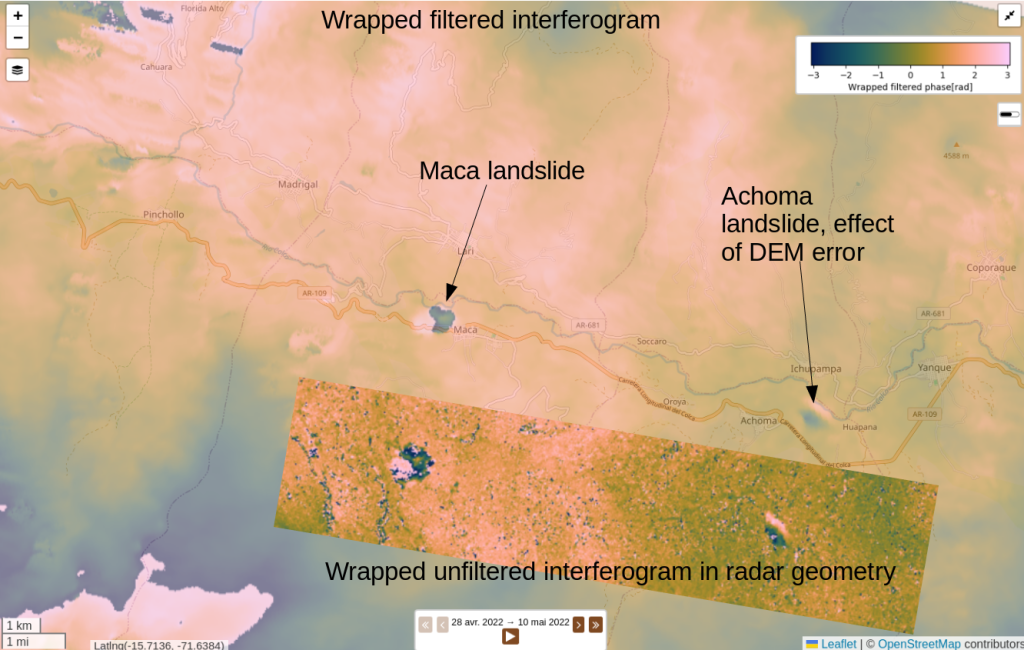
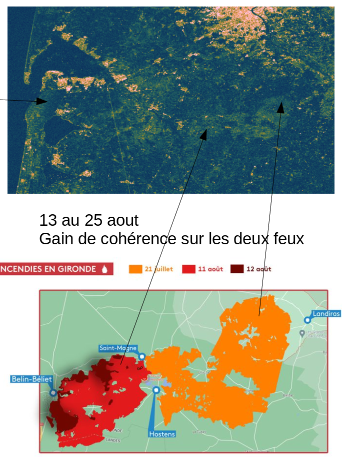
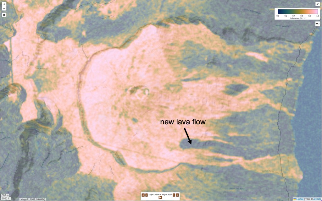
Processing examples are provided below, illustrating different case studies with their interests and limitations. These examples are also grouped together in a web page.
Coordination and management
Claude Boniface (CNES), Erwan Pathier (UGA), Marie-Pierre Doin (CNRS/UGA), Emilie Deschamps-Ostanciaux (CNRS/IPGP)
Scientific team
Responsible: Erwan Pathier (UGA)
Team: Marie-Pierre Doin (CNRS/UGA), Léa Pousse (IRD/UGA)
Equipe Technique
Responsibles: Franck Thollard (CNRS/UGA), Sebastien Gauguin (CNES)
Technical InSAR team : Philippe Durand (CNES), Oliver Henriot (CNRS/UGA), Bertrand Lovery (UGA)
DevOps team: Elisabeth Pointal (CNRS/IPGP), Damien Carcy (Capgemini, CNES), Eric Maesen (Sopra Steria, CNES), Baptiste Meylheuc (CNES), Clément Schaettel (Sopra Steria, CNES), Sami Gasri (Capgemini, CNES)
Previous contributors
Catherine Proy (CNES), Dominique Clesse (Capgemini, CNES), Nelson Nerome (Capgemini, CNES), Marion Fresnes (Capgemini, CNES), Marie-France Larif (CNES), Christophe Laurent (UGA)
Doin, M.; Guillaso, S.; Jolivet, R.; Lasserre, C.; Ducret, G.; Grandin, R.; Pathier, E.; Pinel, V. Presentation of the small baseline NSBAS processing chain on a case example: The Etna deformation monitoring from 2003 to 2010 using Envisat data. In Proceedings of the Fringe 2011 Workshop, Frascati, Italy, 19–23 September 2011
Doin, M.; Cheaib, A; Thollard F., Strategy used for phase unwrapping in the NSBAS MT-INSAR chain, IGARSS 2023: 8210-8213
Grandin, R. Interferometric processing of SLC Sentinel-1 TOPS data. In Proceedings of the FRINGE’15, Advances in the Science and Applications of SAR Interferometry and Sentinel-1 InSAR Workshop, Frascati, Italy, 23–27 March 2015.
Ho Tong Minh, D., Hanssen, R., Doin, M.-P., & Pathier, E. (2022). Advanced Methods for Time-series InSAR. In Surface Displacement Measurement from Remote Sensing Images (pp. 125–153). John Wiley & Sons, Ltd. https://doi.org/10.1002/9781119986843.ch5
Thollard, F.; Clesse, D.; Doin, M.-P.; Donadieu, J.; Durand, P.; Grandin, R.; Lasserre, C.; Laurent, C.; Deschamps-Ostanciaux, E.; Pathier, E.; et al. FLATSIM: The ForM@Ter LArge-Scale Multi-Temporal Sentinel-1 InterferoMetry Service. Remote Sens. 2021, 13, 3734. https://doi.org/10.3390/rs13183734

GDM-SAR-In presentation
Start your calculations
gdm-sar at poleterresolide.fr
Examples of applications and products
