Minute of the PEPS meeting (9/01/2015)
Minute of the meeting on the PEPS platform that took place at CNES January 9, 2015 is now available with the pdf presented during the meeting, on the website in […]

Minute of the meeting on the PEPS platform that took place at CNES January 9, 2015 is now available with the pdf presented during the meeting, on the website in […]
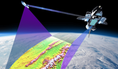
The PEPS platform implemented by CNES in coordination with the French stakeholders will help to repatriate all Sentinels-1 data, except Level 0 data, without geographical restriction. In an attempt to […]
PEPS (Plateforme d’Exploitation des Produits Sentinelles: platform operating Sentinel products) is a project implemented by CNES in coordination with French stakeholders. It aims to provide national access to Sentinel products […]
EPOS is currently at the end of the preparatory phase (2010-2014) and enters into the implementation phase (2015-2040). The WG8 (Satellite Information Data), will be integrated into the implementation phase […]
Minute of the first meeting of the setting up Committee is now available on the website .
The National Geospatial Intelligence Agency (NGA), announced that the highest-resolution (30 m) topographic data over Africa generated from NASA’s Shuttle Radar Topography Mission (SRTM) will be released globally. For more […]
The first meeting of the Setting up Committee will take place on 10 September 2014.
L’information concernant les thèmes qui étaient retenus pour le futur ITT de l’ESA a été publiée mi-février: * Coastal Environment TEP * Forestry TEP * Hydrology TEP * Polar TEP […]
SPOT (Satellite Pour l’Observation de la Terre) is an high-resolution satellite system. It was initiated by CNES in the 1980s for its Earth observation programme. With over 30 million images […]