ForM@Ter and THEIA release a serie of very high resolution topographic models of 140 glaciers worldwide through the PGO FAIR collection
The Pléiades Glacier Observatory (PGO) was initiated in 2016 by French Space Agency (CNES), by the Laboratoire d’Etudes Géophysiques et Océanographiques Spatiales (LEGOS) and by the Institut National des Sciences de l’Univers / CNRS-INSU, under the auspices of the Polar Space Task Group (World Meteorological Organisation). Its aim is to provide repeated observation of more than a hundred of ‘sentinel’ ice-covered sites spread around the world. To achieve this, very high-resolution Pleiades optical images were acquired in stereoscopic mode and topographic models (DSMs – Digital Surface Models), as well as ortho-images, were generated in a standardised way from a stereo-photogrammetric analysis chain operated by LEGOS.
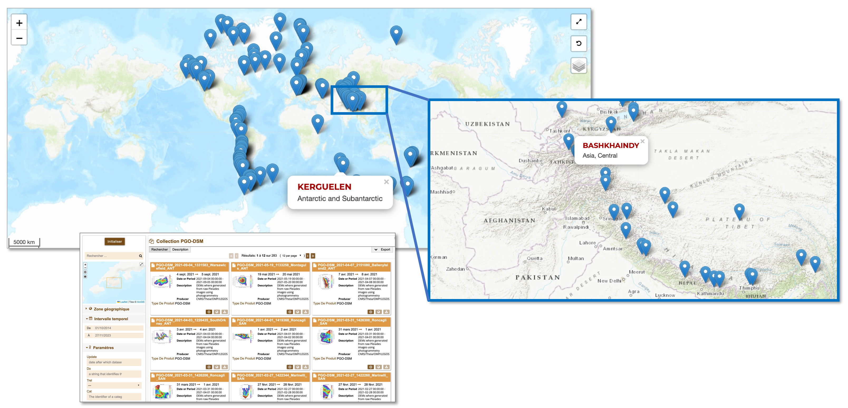
The PGO collection is distributed in accordance with the principles of open science and FAIR data management promoted by Data Terra and its thematic data and services hub ForM@Ter (Solid Earth) and THEIA (continental surfaces). The PGO collection covers 141 sites across the globe, with targeted acquisitions usually at the end of the melt season. These sites include almost 7,000 glaciers, covering a total area of over 20,000 km². The product consists of DSMs with a ground sampling resolution of 2 m and 20 m, as well as orthoimages of 0.5 m (panchromatic) and 2 m (multispectral).
For the analysis process, the Ames stereo-photogrammetric chain (Beyer & al., 2018) was used with optimised processing parameters.
The initial coverage of the 141 PGO sites took place between July 2016 and March 2021, with summer acquisitions alternating between the two hemispheres. Since July 2021 in the northern hemisphere and February 2022 in the southern hemisphere, the PGO has been in revisit mode. Each site will be re-imaged by Pleiades, enabling maps of glacier elevation differences to be produced every five years.
Users can request access to the DSM products under an open CC-BY-NC 4.0 license, subject to the creation of a user ID; access to orthoimages is subject to acceptance of a license by CNES. The first elevation difference maps will soon be added to the collection.
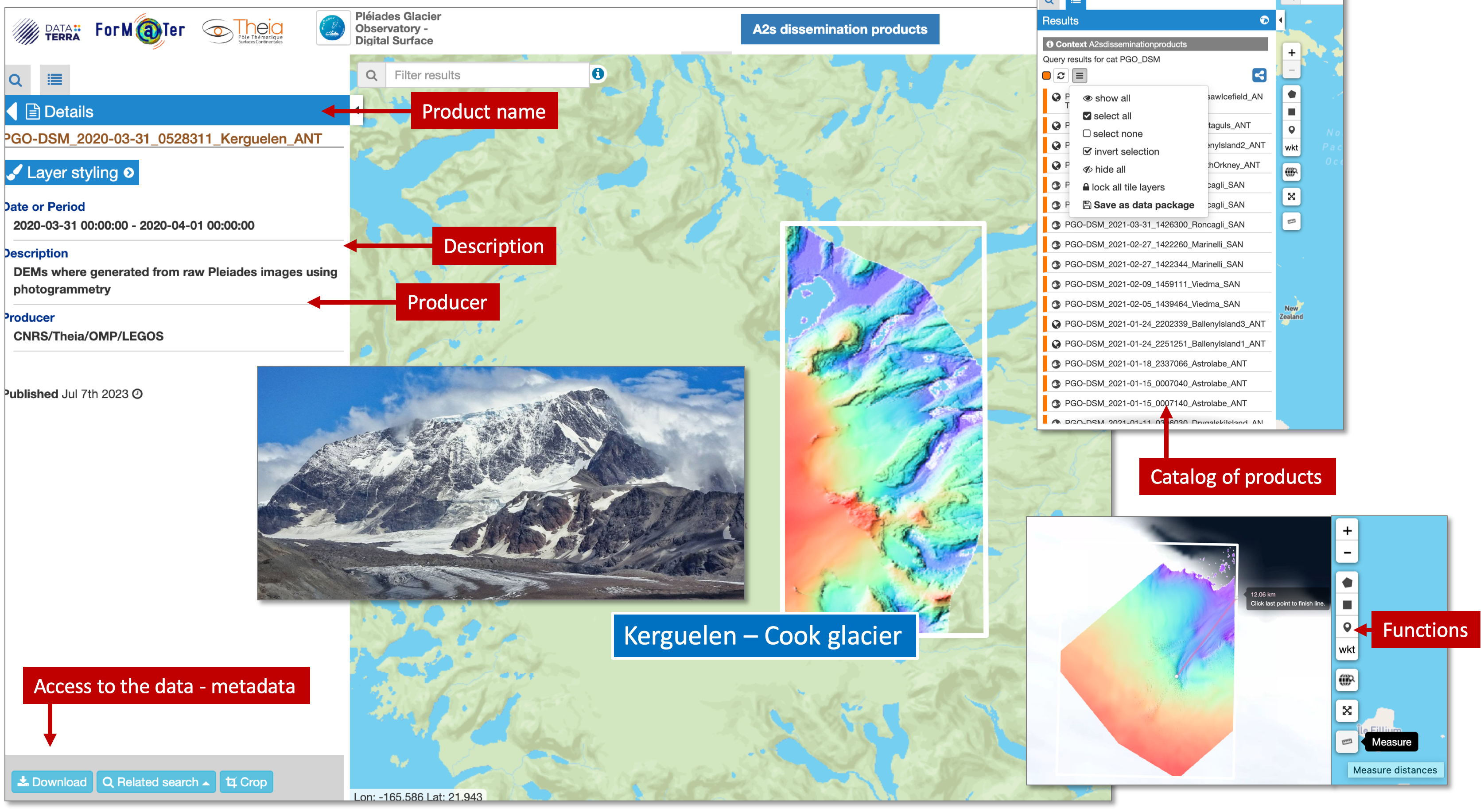
The PGO collection has a DOI and the products are also referenced in the THEIA and ForM@Ter meta-catalogues. Access to the products through a2s-dissemination.u-strasbg.fr
You can find publications from the PGO programme here.
The Solid Earth and Continental Surface science communities thank LEGOS and CNES for their work which will benefit to the whole glaciology community.